Tropical Storm Ian primed to power up and hit Florida as hurricane
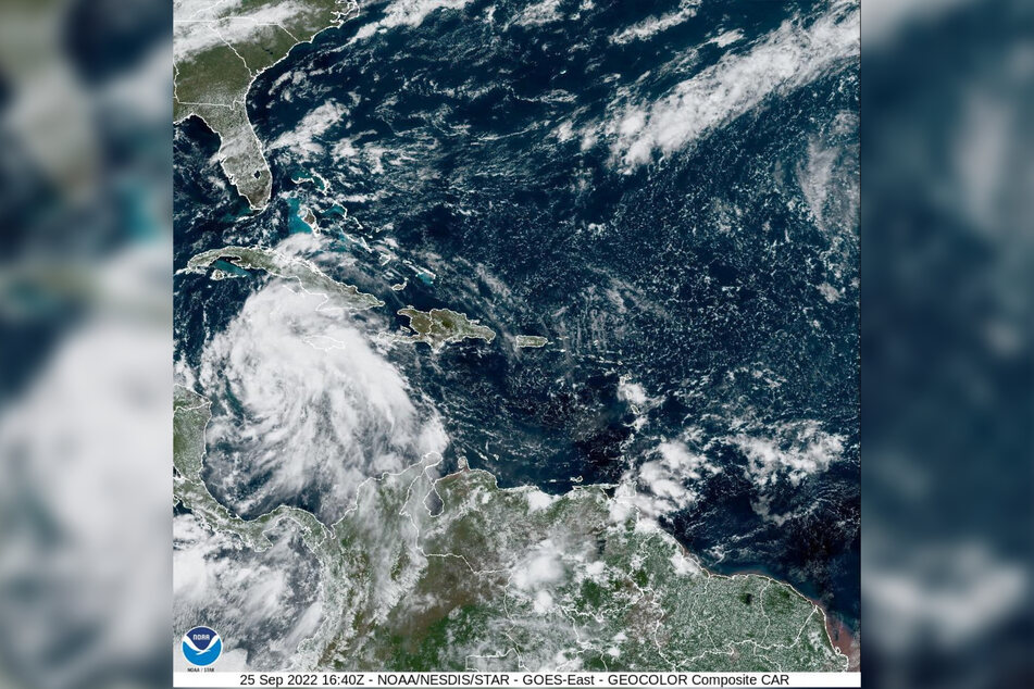
Tallahassee, Florida - On Sunday morning, Tropical Storm Ian remained on track for a potential landfall somewhere along the Florida Gulf coast later this week – with the Big Bend area in the center of a forecast track that could still change.

The storm continued to slowly organize, but by Monday the National Hurricane Center expects it to morph into a monster, approaching Cuba on Tuesday as a Category 4 storm with 130 mph winds. The western part of the island, including Havana, was now under a hurricane warning.
By early Wednesday, Ian is expected to be more than 100 miles west of Key West – a dangerous system with its final destination still up in the air.
At 2:00 PM EDT Sunday, the latest track from the National Hurricane Center continued a westward trend that kept much of South Florida, including the Florida Keys, solidly out of the cone of uncertainty. But forecasters warned that the cone only shows where the most powerful eye of the storm might go.
The NHC predicts the system could begin to weaken before it makes landfall, possibly as a Category 1 along the Big Bend on Friday, but heavy rain and winds could be felt throughout the state next week. If comes ashore sooner near the Tampa Bay area at the eastern edge of the cone, the storm could be stronger.
Jamie Rhone, acting director of the NHC, warned southeast Florida and the upper Keys not to tune out the storm just yet in a Sunday morning broadcast.
"You can’t be too fixated on this cone and it moving around a little bit," he said. "The track has now shifted just enough that you’re out of the damaging wind potential, but I still need you to prepare for heavy rains and some of the gusty squalls."
Florida remains under state of emergency

All of Florida remained under a state of emergency and President Joe Biden declared a state of emergency in Florida Saturday night. Officials in the Florida Keys met Sunday and once again bumped the decision to call for evacuations to Monday, though that seemed increasingly unlikely.
Florida’s west coast – and Tampa Bay in particular – is uniquely vulnerable to storm surge. The shallow shelf in the Gulf of Mexico can push tremendous amounts of water onshore, especially if the storm is slow moving and "weaker," as the hurricane center is currently predicting.
Rhome, acting NHC director, said the region had "perhaps some of the highest vulnerability in the country" to storm surge.
"I’m telling you it doesn’t take an onshore or a direct hit from a hurricane to pile up the water," he said. "We could see a significant amount of storm surge on the west coast of Florida even if the storm stays offshore."
Tropical Storm Ian’s new projected path means Floridians could start to feel its winds and rains slightly later than originally predicted, with winds picking up on the west coast starting Tuesday evening and rising to hurricane-force starting Wednesday morning.
The Miami office of the National Weather Service said rainfall is expected to be heaviest Tuesday and Tuesday night, but it could linger through Wednesday. South Florida could see about 2 to 6 inches of rain, especially near Flamingo.
Western Cuba, which could start to experience hurricane-force winds Monday night or early Tuesday, is projected to see 4 to 8 inches of rain, according to the hurricane center. The biggest danger for Cuba may be storm surge, which could swell 9 to 14 feet above normal overnight Monday and early Tuesday.
Cover photo: Collage: Gregg Newton / AFP & REUTERS