Hurricane Ian rapidly weakens to Category 2 after massive flooding
Fort Myers, Florida - Hurricane Ian is quickly weakening as it treks up toward Central Florida, downgrading to a Category 2 – marking the beginning of the end for the historic storm that crashed into the US coast with winds of 150 miles per hour just hours earlier.

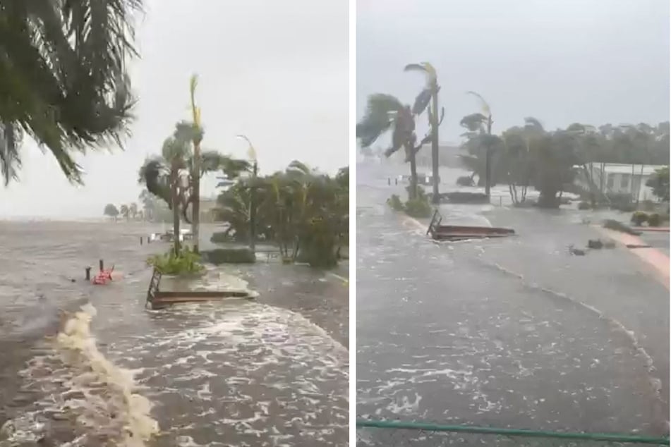
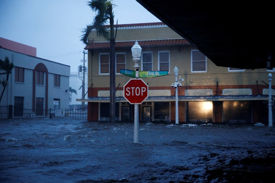
However, southwest Florida is still being pounded with "catastrophic" flooding, winds, and a dozen feet of storm surge. Ian brought record-breaking storm surge highs for Key West, Fort Myers, and Naples several feet above previous high water marks.
Numerous videos posted on the internet show torrents of seawater washing away stop signs, cars, boats, and homes. Entire city blocks were submerged Wednesday afternoon, and forecasters noted the worst of the surge was yet to come.
Ian followed an eerily similar path to the last storm to menace southwest Florida – 2004’s Hurricane Charley.
But Ian is a far bigger, wetter, and slower storm. Its wind field covered most of the state on Wednesday, and its projected path as a strong but slow-moving storm across Central Florida is expected to last another full day as it drenches the middle of the state with near-record rainfall.
Over a million Floridians were without power Wednesday night – a number that is expected to soar as Ian crosses the state. Utility leaders cautioned that it could take a while for the lights to come back because they need to rebuild parts of the grid crushed by Ian’s Category 4 winds.
Hurricane Ian leaves hundreds of Floridians in need of rescue

Hundreds of Floridians who didn’t evacuate ahead of Ian were calling for rescue, and with 911 centers down in big, affected counties like Lee, officials don’t yet know how many might need to be saved.
Gov. Ron DeSantis said rescue crews will move in by land, air, and water as soon as it’s safe, and noted he’d asked the Department of Defense for extra high water vehicles and aerial rescue equipment to help the response.
"Those people are being logged, and there will be a response," DeSantis said. "But it’s likely going to take a little time for the storm to move forward so that it’s safe for the first responders to be able to do that."
While the worst of the winds and surge had faded for the Florida Keys by Wednesday afternoon, it left behind flooded homes and impassable streets. South Florida saw tornadoes overnight that flipped small airplanes, cracked apartment buildings in half, and took down big trees as the streets flooded under the heavy rains and high king tides throughout the day Wednesday.
Ken Graham, director of the National Weather Service, called Hurricane Ian a "historic event."
"This is going to be a storm we talk about for many years to come," he said.
Hurricanes Ian’s winds continued to dramatically weaken after it came ashore Wednesday afternoon, with maximum sustained winds dropping to 105 mph by 9:00 PM from a peak of 155 mph.
Cover photo: Collage: REUTERS